What a hike! Yushan't see another view quite like this one
Mount Yushan is not only the tallest peak in Taiwan, it’s the tallest mountain in North East Asia. At a 3,952 meters, almost 13,000 feet, it’s higher than Japan’s Mount Fuji, and as our trekker operators can tell you, it’s no easy climb.
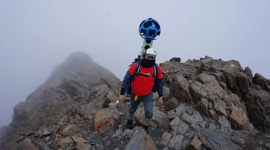
Now you can get to the top of the peak without breaking a sweat, with the launch of Mount Yushan on Street View.
Regarded locally as a symbol of the Taiwanese spirit — fierce and beautiful — Yushan draws hikers from around the world. The lower part of the track starts as a nice walk in a lush and picturesque forest. However the final stretch is a real feat to accomplish. The track narrows down to a ledge which zigzags along a cliff face. Our trekker operators, carrying the 18kg Trekker to capture the mountain in all its splendour, held onto chains on some parts of the track, but higher up they had nothing but their feet for support.
The journey might be daunting, but the view from the top makes it all worthwhile. During the winter months, Yushan is capped with thick snow that glimmers like jade which is why people often refer to it as “Jade Mountain”.
Discover more behind-the-scenes shots from the climb and the collection here: